

Where is Dhamar Governorate located?
The governorate lies among a number of other governorates: Sana'a governorate to the north and northeast, Al-Bayda to the east, Ibb to the south,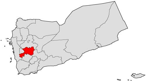 and Raymah and Al-Hudaydah to the west. The center of the governorate is about 100 km from the capital Sana'a.
What is the size of Dhamar Governorate?
Dhamar governorate is about (7586) km2, divided among (12) districts.
What is the population of Dhamar Governorate?
According to the 2004 census, Dhamar governorate includes (1,329,229) people, most of whom live in the governorate's 3,262 villages. Its annual population growth rate is (3.04%).
What are the districts of Dhamar Governorate?
The governorate is divided into (12) districts, according to the last administrative division as follows:
- Al Hada District
- Al Manar District
- Anss District
- Dawran Aness District
- Dhamar City District
- Jabal Ash Sharq District
- Jahran District
- Maghirib Ans District
- Mayfa'at Anss District
- Utmah District
- Wusab Al Ali District
- Wusab As Safil District
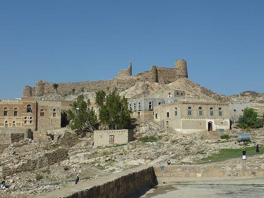
What are the most major tourist and historical landmarks in Dhamar Governorate?
Dhamar contributed actively in the march of civilization in Yemen, with ancient monuments dating back to 1000 B.C. at places such as al-Sha'b al-Aswad and Masna'at Marya.
It also includes various touristic and historical monuments, such as Dhamar Regional Museum, Baynoun Museum, Utmah nature reserve, Wadi Sirba, Jahran plain, and Mount Harran.
What is the climate of Dhamar Governorate?
The governorate in general lies 1,600–3,200 m (5,200–10,500 ft) above the sea level, with a topographic relief that varies from high mountains to deep valleys, upland plains and plateaus. The governorate's climate is characterized by generally mild, and tends to be cold in winter in its central and eastern parts, and a moderate warm climate prevails in the western valleys and slopes regions.
Sources:
- Central Statistical Organization, 2006
- Wikipedia - National Information Center (Arabic)
- HUMAN ACCESS (Media Center)
- Yemen figures and facts (the National Information Center).
- Results of the tourism survey during the period from (1996-1999)
